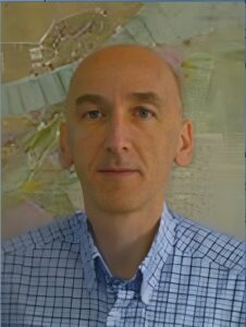
György Domokos
After graduating from university, he was a senior lecturer at the Land Survey Department of the Metropolitan Land Office, then head of the newly established Computer Science Group. He was a member of the international expert group preparing the short and medium-term strategy of the national IT project developed by the land office called TAKAROS.
Between 1989 and 2007, he was the CEO of Geocomp Ltd., then ESRI Hungary Ltd. After that, he was the organizational director of Térképtár Ltd. until 2010. After that, he was the project manager of VÁTI Hungarian Regional Development and Urbanism Nonprofit Ltd.; then, from 2011, he was the business development manager of Airbus DS Geo Hungary Ltd.
Since 1993, he has led GIS practices at the Department of Cartography and Geoinformatics of Eötvös Loránd University (ELTE) - as a "Master Teacher" since 2004. Since 1998, he has been giving lectures on the subjects "Urban Systems" and "GIS Case Studies 2" of the Human Geographic Information Technology engineering training organized by the Department of Photogrammetry and Geographic Information Technology of the Budapest University of Technology and Economics (BMGE).
From 2001 until its closure, he was a member of the board of trustees of the HUNGIS Foundation; and since 2006, he has been a member of the board of trustees of the Urszinyi Endre Study Foundation.
He led the Geoinformatics Department of the Hungarian Society of Surveyors, Cartographers and Remote Sensing for two terms and represented it in the CLGE (Comité de Liason des Géométres Européens - Council of European Surveyors). He participated in the organization of the CLGE 2013 general assembly in Budapest and the related SpaceExpo, as well as the annual “European Surveyors and Geoinformatics Day” (it was thanks to his organizational work that the CLGE included Lóránd Eötvös in the list of famous European surveyors).
He was a regular speaker at the National Geospatial Information Conferences and the GISopen conferences in Székesfehérvár.
In 2020, the Hungarian Society of Surveying, Cartography and Remote Sensing (MFTTT) awarded him the Lázár deák Memorial Medal.
Created: 2023.12.12. 22:41
Last modified: 2023.12.13. 19:48

